Wednesday, November 30, 2016

Fantasy Cartography with Butch Curry: an inspirational resource

This post is part of a series to augment the Guest Resources available for free download.

This and other guest-inspired content is gathered in my Guest Directory for you to explore.

Find more world workshops in my Worldbuilding Directory.


I first encountered Butch Curry's YouTube tutorials when working on an online role-playing game with a few friends of mine. I had no deftness in Photoshop then, so a more skilled friend searched for some tutorials on how to make digital fantasy maps. She discovered this wonderful series of video podcasts titled Fantasy Cartography with Adobe Photoshop. I watched a few tutorials to learn what sort of map was possible, and my friend started making the maps for our game.

Much later, when I started revamping the first manuscript for my Tales of the Known World saga, I recalled those tutorials and the pretty maps my friend created. I grabbed a notebook and set to work taking notes on the tutorials, everything from specific commands and settings to Butch's broader ideas about cartography theory.


Check out these Guest Resources for more inspirational content!


In his video podcast, Butch demonstrates step-by-step how to pull up different filters, create certain layer types, and execute a variety of useful commands in Photoshop. He also introduces a helpful Photoshop philosophy.

Butch focuses on using flexible tools that maintain independence from other design elements. This allows future changes without a great amount of effort. Whether you're new to Photoshop or just new to digital cartography, Butch Curry's Fantasy Cartography with Adobe Photoshop is a valuable resource I am proud to recommend.


And be sure to subscribe to Butch's awesome channel, if you haven't already!


That's it for this post! Check out the latest guest-inspired content for more.

Download the Guest Resources here, or start your adventure below.


Liked this? Share, please!

Friday, November 18, 2016

Styling the Cartography of Awakening: a mapping resource

This post is Part 2 of a series to augment the Codex of the Known World available for free download. Start with Part 1 here.

This and other mapping resources are gathered in my Cartography Directory for you to explore.

Find my maps and atlas content in the Map Directory.


After planning out the maps for my first book in Part 1 of this series, I chose an old-world style of mapping that resembles antique watercolor. However, this style uses topography symbols for mountains and forests, and I had to plan for the limitations of this cartography style.

On my maps, all mountain symbols are the same size, no matter the variations in altitude. In addition, the mountain symbols are roughly the same size as the treetop symbols for my forested areas. But I decided my audience would still read the landscape correctly, despite how the style compromised the literal accuracy of the maps.

However, my mapping style is also ill-suited to showing transitions. A topography symbol is either present or absent, whereas real land can transition gradually over huge areas. In order to define the topography borders in my maps, I had to decide what thresholds the land must reach in order to be marked with a symbol.


Check out the Codex of the Known World for more resources!


For my forests, I marked dense vegetation but did not mark the scraggly areas where trees give way to open sky. For my mountain symbols, I chose to mark all areas of stony elevation. Then I used small mountain peaks to denote lower-lying stony areas. By deciding these thresholds ahead of time, I stayed consistent throughout my whole atlas.

My cartography style uses more symbols to depict towns and landmarks, none of which can be drawn to scale. These discrepancies cause exact placement to be vague, especially when I map a zoomed-in portion of a previous map. For the first book in my Tales of the Known World saga, I decided to use the base of each symbol for vertical placement, and to center each symbol horizontally.

By considering the inaccuracies of my mapping style, I achieved a map aesthetic that captures the spirit of the Known World. I defined the symbols I planned to use and guidelines about their placement, representing my world without falling prey to inconsistencies between maps.


That's it for this post! Up Next: The apprentice cartographer's story...

Download the Codex of the Known World here, or start your adventure below.


Liked this? Share, please!

Wednesday, November 16, 2016

Plan Your Rivers: a cartography workshop

This post is Part 1 of a series to augment The Worldbuilder's Handbook available for free download.

This and other world workshops are gathered in my Worldbuilding Directory for you to explore.

Find more map-making content in my Cartography Directory.


As a worldbuilder, you have ultimate control over how your rivers flow, where your towns spring up, and the way your roads connect. But to create a realistic world that immerses readers in your story, you must consider some basic concepts about how lands form and civilizations rise. This implicit dynamic between rivers, towns, and roads will either lend credibility to your world or detract from the story at hand.

Rivers form when a region of land sheds water. Instead of fully absorbing into the soil, the water flows across the land, following the pull of gravity from highlands into lowlands. Small rivers tend to feed into larger rivers, and rivers tend to widen and slow down as the land flattens. A river basin or river valley is the depression in the land that guides the water downhill and to the coast. These basins are ringed with comparatively higher elevations, which channel the draining water into each basin.


Check out The Worldbuilder's Handbook for more free resources!


To plan your river, decide on the general type of rock or soil in a given basin, and then think about how much rainfall or meltwater that basin might shed in an average year. If that amount of water feels large enough to represent on your map, draw it in an appropriate width for its volume and speed. Add lakes or floodplains in the pockets of low elevation along your river, if they seem large enough to represent at scale.

Floodplains form when the volume of draining water increases suddenly, often due to a rainy season or spring thaw. The water level of the river rises, flooding its banks and picking up extra soil and other debris. Steep banks can constrain the rising waters, but riverbanks with gentle slopes allow the water to spread out. This slows the river's overall speed, and its fertile sediment settles over the flooded land. After the extra water drains into the sea, the floodwaters recede and the sodden floodplain is revealed.

To finish your river, assess how freshwater meets saltwater at the river's mouth. The elevation of land here impacts the way your river spills into the ocean and dumps the remaining sediment it has collected on its path. With the free exclusive How to Make Fantasy Maps in Photoshop, you can account for this sediment in the shallows and vegetation of each river's mouth.

Flat plains often host wetlands and river deltas, where the slow-moving sediment collects near the shoreline and builds up into islands or brackish swamps. Sandy beaches tend to be somewhat steeper and have thinner river mouths, increasing the river's speed. This can deliver sediment further out to sea, creating wide shallows or sandbars. Rocky bluffs often produce waterfalls or deep gorges, where fallen stones jut from the seas and the sediment is churned out into the depths.


That's it for this post! Up Next: How civilizations arise along rivers...

Download The Worldbuilder's Handbook here, or start your adventure below.


Liked this? Share, please!

Friday, November 11, 2016

Planning the Cartography of Awakening: a mapping resource

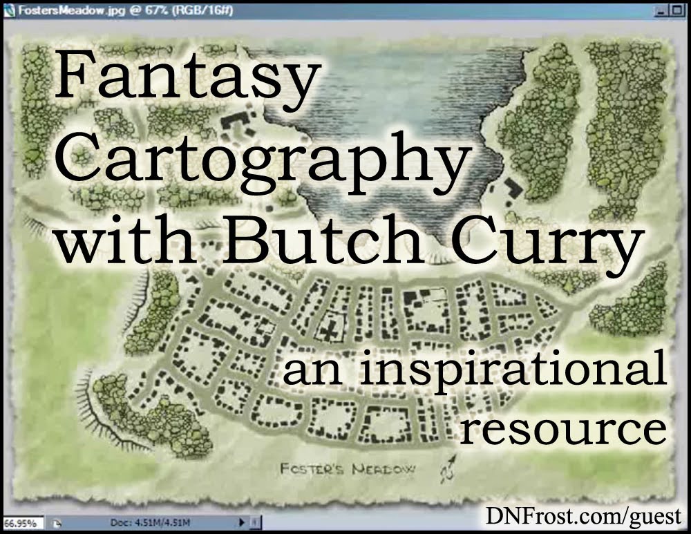
This post is Part 1 of a series to augment the Codex of the Known World available for free download.

This and other mapping resources are gathered in my Cartography Directory for you to explore.

Find my maps and atlas content in the Map Directory.


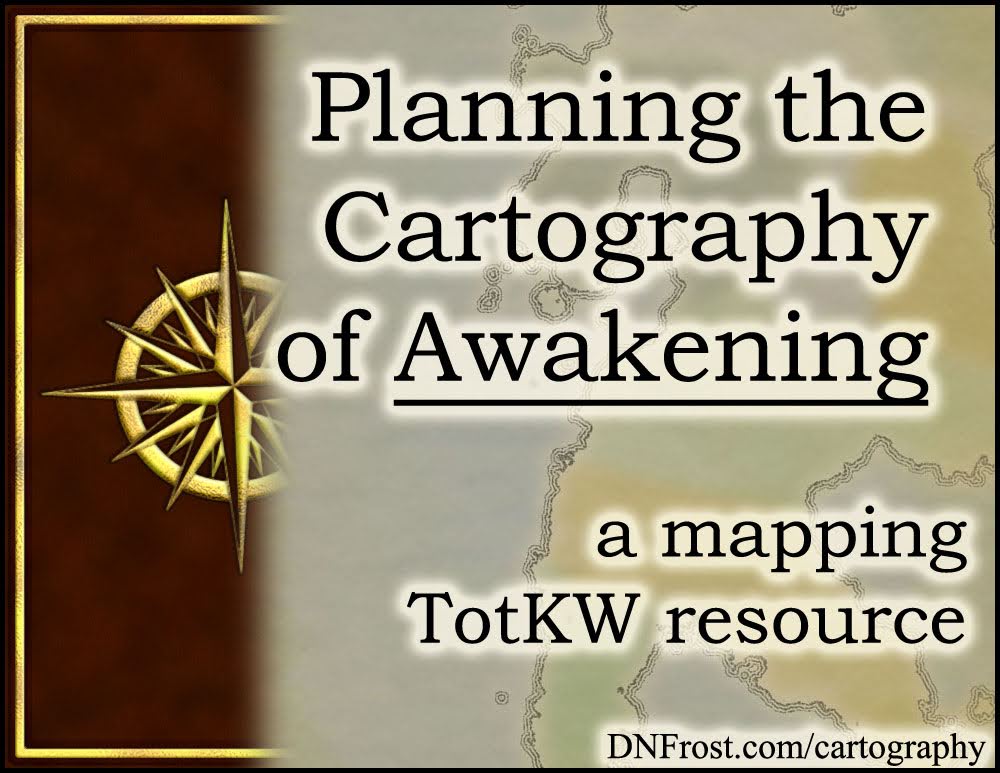
Before I could make any maps of the Known World, I had to decide what to show and what to omit from each map. I took some time to reflect on each map's audience, the best boundaries for each map, and the best dimensions to depict those boundaries. This gave me a basic level of detail possible for each map scale.

1) Map Audience: My maps are mostly for readers and fans, but also for me to print at home and use for reference. Instead of revealing my entire world to readers, I decided to only depict the area of the world known to the characters in my first book. Still a large area, the Known World refers to the lands united by the Katei Ocean, but it does not depict the Unknown East.

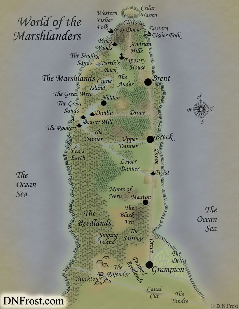
2) Boundaries: My first map depicts the full Known World, and subsequent maps show more detailed close-ups. For each map, I chose to represent a single region or cohesive area, with map boundaries no less than a half-inch from the edges of the region. With those dimensions set, I centered each region on the page, allowing for slight adjustments to omit distant islands or include important towns.


Check out the Codex of the Known World for more resources!


3) Dimensions: The Known World is wider than it is tall, so I chose a landscape orientation. To optimize the print-at-home dimensions of letter-sized paper, I decided to make all my maps 8.5" x 11". Print-quality resolution is 300 dpi (dots per inch), so I made my Photoshop documents 3300 x 2550 pixels. Coupled with my chosen map boundaries, these dimensions established a scale for each map.

4) Detail: The Known World map can only hold so much detail, because text labels blur at smaller sizes. In order to shrink my finished maps for online display, I realized I needed to leave some wiggle room to maintain legibility. With some baselines established, I decided to streamline the text in my world map and emphasize important details in my subsequent maps.


Since I wanted to make more than one map, I also had to make some decisions about the overall body of maps. To ensure a sense of continuity between maps, I needed to know how the maps would relate to each other. For cohesion with the plot of my book, I wanted to plan where each map would best fit into the story. And I had to consider how I'd present the finished maps in my Tales of the Known World saga.

5) Map Relations: Most of my maps depict the modern Known World as known to the people who live there. The sole exception depicts a lost land of the ancient world, as that land is known to the people in the modern world. I decided to make each map with identical Photoshop techniques, and to only use techniques that looked possible for a map-maker within the Known World.

6) Fitting the Story: Each book, section, and chapter receives a map as part of my writing process. A book's main map depicts the whole Known World, while each of the book's four section maps depicts an area conceptually or contextually relevant to the upcoming story arc. For each chapter, I also map a new region in which a scene from that chapter takes place. These thematic guidelines ensured my maps felt relevant throughout the storyline.

7) Presentation: Each map appears on the left side of a two-page spread in my book, with north aligned to the left edge and relevant text on the right side. The Known World map faces my table of contents, and each section map faces prophetic text heralding the events about to unfold. Chapter maps face the opening text of each chapter. For variety and ease of reading, I decided to make all chapter maps in portrait orientation, with north along the top edge.


That's it for this post! Up Next: How I picked the mapping style for Book 1...

Download the Codex of the Known World here, or start your adventure below.


Liked this? Share, please!

Wednesday, November 9, 2016

The Worldbuilder's Handbook: a workshop directory

This post is part of a series to augment The Worldbuilder's Handbook available for free download.

This and other world workshops are gathered in my Worldbuilding Directory for you to explore.

Find more content navigation in my Resource Directory.


Hello, there! Thanks for your interest in my worldbuilding techniques. My name is D.N.Frost, and I'm a fantasy author, fictional cartographer, and extensive worldbuilder. After designing myriad cultures, constructing multiple languages, and producing numerous maps for my Tales of the Known World saga, I've developed a realistic approach to building a complex world.

How exactly do you build a fictional world? I realized that a world's cultures, languages, and geography are connected, and that they influence each other through the course of history. To build more realism into your invented worlds, please enjoy this collection of short worldbuilding tips and workshops from TotKW Books.


Download your workshop guide The Worldbuilder's Handbook here.


These are workshops on worldbuilding and supporting examples from the TotKW universe. This nuanced approach to realistic worlds will help you build and share your world with more confidence. Your handbook will guide you through important facets of worldbuilding, from creating your first map to finding inspiration for new place-names.

This resource directory also links to a number of worldbuilding resources and longer blog posts, so you can delve deep into your favorite concepts. I'm proud to offer you this compilation of tips for worldbuilders, and I hope you use this resource to enhance your world.


That's it for this post! Check out the latest worldbuilding workshops for more.

Download The Worldbuilder's Handbook here, or start your adventure below.


Liked this? Share, please!

Wednesday, November 2, 2016

World of the Marshlanders: a map commission

This post is Part 1 of a series to augment the Fictional Cartography by D.N.Frost available for free download.

This and other map commissions are gathered in my Portfolio Directory for you to explore.

This post is also Part 1 of a series about Annis Pratt.


I first encountered professor-gone-author Annis Pratt when a previous map client recommended my services for Annis's series of published novels. Annis writes eco-fiction, promoting a sustainable and ecologically-friendly paradigm through the adventures of the Marshlanders in her invented world.

I said hello and clicked eagerly around her website, absorbing a cool sense of the world Annis had created. Then I invited her to connect with me for a map estimate when the time was right.


Check out this Fictional Cartography by D.N.Frost for more maps!


After a few months, Annis was ready to tackle her map, and I was thrilled when she contacted me to get started.

Annis provided me with a few pencil sketches of her world, and I started on a commission estimate for the entire map.

We discussed her map needs and budget to finalize our map plan, and I created her initial render.

I sent the mock-up to Annis for consideration, and she decided to commission the project.


Here's what she had to say about the finished map:


World of the Marshlanders, a map commission by D.N.Frost for Annis Pratt www.DNFrost.com/portfolio Part 1 of a series.
Bravo! It looks terrific.

I sense you have put extra work into this marvelous map.

I am impressed with your business procedures and art work.

I appreciate your thoroughness.

This is going to work well with a submission I'm just doing.

Thanks for everything. Terrific!

– Annis Pratt, eco-fiction author


That's it for this post! Up Next: Laying out tons of topography... Soon.

Want to bring your own world to life? We can map your world.
You deserve a professional map you can be proud to share.

Download Fictional Cartography by D.N.Frost here, or start your adventure below.


Liked this? Share, please!

Tuesday, November 1, 2016

Portent V of Broken: a riddle in rhyme

Portent V of Broken: the prince is born on builder's reef www.DNFrost.com/prophesy #TotKW A riddle in rhyme by D.N.Frost @DNFrost13 Part of a series.
In the novel Broken, there are 24 portents fortelling the events of the unfolding saga.

Start with Portent I here.

These and other riddles in rhyme are gathered in the Portents Directory for you to explore.

Enjoy!


The prince is born on builder's reef
To father's word and mother's grief
In duty shunted to the shore
To sighted land for coming war (I)

His advent clears the palace house
Who dynasty and truth espouse
While prophesy of import lost
Defies the dead at deadly cost

Across the waves the daemons sail
Beneath the waves a bloody trail
As rushes prince to father's side
To sacred truth of time abide. (II)


Can you decode the future Tales of the Known World?

Share your interpretation!
Comment below with your take on this portent.


This prophesy was said 32 years before Broken takes place, and it is referenced within the story as Tirrok explores the circumstances of his birth on his quest to the world of the merfolk.

Where is the builder's reef, and what prophesy of import lost do you think this portent heralds?


Download the Prophesy Appendix:

The merfolk culture is built on the prophetic Gift. Nearly all men produce a portent every twenty days, and they devote their lives to interpretation. For more about the role and inner workings of prophesy, check out the Prophesy Appendix above.


Alongside every prophesy is an attribution block. This block contains a byline giving the name of the person who said the prophesy, and a dateline giving the day the prophesy was first said. Here is the attribution for this portent:
Gynlen Njyae Dynde VI
1:2:3:4/13, 7:3:2 IX
V:I 2:1:2:2/11, 8:1:2
V:II 3:1:4:6/5, III:IX
The portent attributed here references multiple events that come to pass in sections called tatters. An additional tatter dateline has been added to the attribution for each tatter, noting the date when that segment of the portent will come to pass.


That's it for this post! Up Next: Imbues anew the land of yore...

For the Prophesy Appendix, enter your email above.


Liked this? Share, please!
Hello, there! Connect with me:
TwitterFacebookPinterestInstagram

Leave a comment, ask a question, share a story, make a friend.