
This and other world workshops are gathered in my Worldbuilding Directory for you to explore.
Find more map-making content in my Cartography Directory.
As a worldbuilder, you have ultimate control over how your rivers flow, where your towns spring up, and the way your roads connect. But to create a realistic world that immerses readers in your story, you must consider some basic concepts about how lands form and civilizations rise. This implicit dynamic between rivers, towns, and roads will either lend credibility to your world or detract from the story at hand.
Rivers form when a region of land sheds water. Instead of fully absorbing into the soil, the water flows across the land, following the pull of gravity from highlands into lowlands. Small rivers tend to feed into larger rivers, and rivers tend to widen and slow down as the land flattens. A river basin or river valley is the depression in the land that guides the water downhill and to the coast. These basins are ringed with comparatively higher elevations, which channel the draining water into each basin.
Check out The Worldbuilder's Handbook for more free resources!
To plan your river, decide on the general type of rock or soil in a given basin, and then think about how much rainfall or meltwater that basin might shed in an average year. If that amount of water feels large enough to represent on your map, draw it in an appropriate width for its volume and speed. Add lakes or floodplains in the pockets of low elevation along your river, if they seem large enough to represent at scale.
Floodplains form when the volume of draining water increases suddenly, often due to a rainy season or spring thaw. The water level of the river rises, flooding its banks and picking up extra soil and other debris. Steep banks can constrain the rising waters, but riverbanks with gentle slopes allow the water to spread out. This slows the river's overall speed, and its fertile sediment settles over the flooded land. After the extra water drains into the sea, the floodwaters recede and the sodden floodplain is revealed.
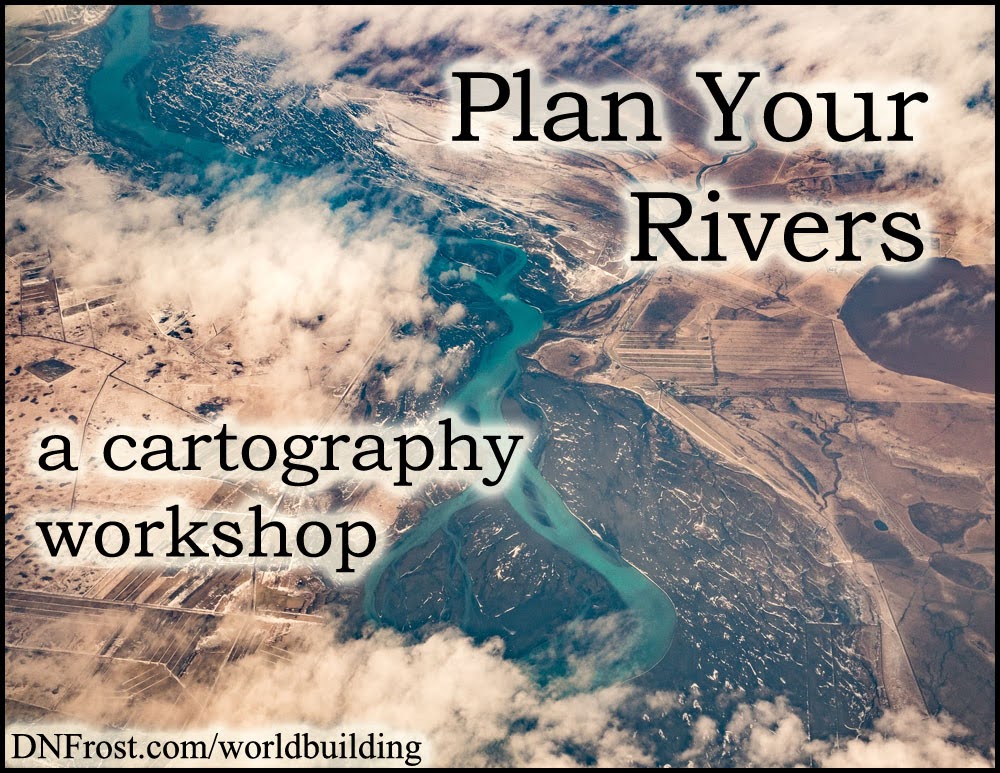
To finish your river, assess how freshwater meets saltwater at the river's mouth. The elevation of land here impacts the way your river spills into the ocean and dumps the remaining sediment it has collected on its path. With the free exclusive How to Make Fantasy Maps in Photoshop, you can account for this sediment in the shallows and vegetation of each river's mouth.
Flat plains often host wetlands and river deltas, where the slow-moving sediment collects near the shoreline and builds up into islands or brackish swamps. Sandy beaches tend to be somewhat steeper and have thinner river mouths, increasing the river's speed. This can deliver sediment further out to sea, creating wide shallows or sandbars. Rocky bluffs often produce waterfalls or deep gorges, where fallen stones jut from the seas and the sediment is churned out into the depths.
That's it for this post! Up Next: How civilizations arise along rivers...
Download The Worldbuilder's Handbook here, or start your adventure below.

Liked this? Share, please!


No comments:
Post a Comment